
Valley Center
2015 You do not need to drill down to 1000 of 1500 feet for water.
Eddie A, Spearhead Trail, VC, Ca. Profiling performed in January 2013. Around May 2015 started drilling, stopped the driller around 310 feet in depth. Well yield was 100 gallons per minute (gpm).
We are now 10 years into the drought and at a shallow depth there is 100 gpm. That’s surprising. Drilling closer to the heart of the fractured system, yields more water.
** Driller was Stehly Brothers. We do not recommend this driller anymore.
….....................................................................................................................................
Detailed survey produces the best results around 90% of the time.
To whom it may concern.
March 2000
I am a thirty year resident of Valley Center who has been dependent upon well water the whole time. I began farming with two wells and over the years drilled five more as my water usage grew. The first three were located by a dowser friend of mine. However, in the spring of year 2000, my luck ran out when I drilled a 1000 foot essentially dry hole.
At that point I ran into Bob Hutchings, a well known and very knowledgeable grove owner and manager, who suggested I have Tony at WaterLocating.Com survey that site. After meeting with Tony, listening to his presentation and reading the testimonials of other growers that I have personal knowledge of, I was convinced to have Tony do a complete survey of the site in the vicinity of several existing yet small wells.
The results were amazing and made me a believer in Tony's science and technique.
Tony located my aquifer in an area previously rejected by two dowsers. Through his computer profiles he estimated the approximate depth, (3 to 5 hundred feet) and even predicted a 250 gpm result. He was right on! The driller called it a 350 gpm well in his report. We estimated 600 gpm flowing out during the drilling process and later opted to install a 150 gpm pump.
I would never drill another well without first having WaterLocating.Com do a complete survey of the area. The cost of drilling and the value of water makes that a no-
Thanks Tony for a job well done.
Pete Clay,
Valley Center Grower
This is a hard rock aquifer signature.
Four slices of earth, vertical profiles taken 20 feet apart. It is obvious where Pete drilled. Each vertical increment is 100 feet in depth.
See an example "Profile Model in 3D View" < click me.
The darker area characterizes the hydro-
tice how the geometry of the hydro-
That is because there is no standard within aquifer geometrics.
Around 250 feet away from this profile there is a water witched well drilled to a 1000 foot deep with around 2 GPM and a 300 foot well in the other direction with only a 5 GPM yield.
When drilling for a water well you are taking a chance with witchers and non-
Your best chance to reduce expense is with a DETAILED WaterLocating.Com analysis.
The darker area characterizes the hydro-
WaterLocating.Com quantitative analysis can estimate the water content in 3 graduations when sufficient information can be extracted from your subsurface.
Approximately one to 20 GPM, approximately 20 to 60 GPM, and greater than 60 into the hundreds of GPM 90% of the time.
….....................................................................................................................................
Ralph & Manny, Valley Center, Ca., flower growers, May 1, 2008, 150+ GPM, 680 feet, static level @ 100 feet. They knew that they had to go deep on this one. Well drilled on the top of a hill. Drilled, Valley Center area, San Diego County Area, 100 gpm. Driller was AAA Drilling **
…....................................................................
Al Campos, Valley Center, first well, 2007 70 GPM, 150 feet, second well April 2008 60 GPM, 400 feet, APdrywall@sbcglobal.net. A water-
…....................................................................
(1) Detailed survey produces the best results around 90% of the time.
Old well drilled to 600 feet at the well drillers selected location and hit minimal water. Enlisted WaterLocating.Com's services and drilled approximately 250 feet away from the first well and received 70 gallons per minute within.
Jack Button, Cuca Ranch, Ca.
Driller was Fain Drilling **. Here are some extra well logs where Fain struck good water on a computer generated target. Driller, Fain drilling. **
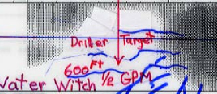
This is the profile of the 70 GPM well drilled at the right, dark area. At the red arrow is a strong water witching (dowsing), spot. Selected in the hard hard rock zone. Drilled to 600 feet with only a 1/2 gallon per minute output.
600 feet at depth @ $10.oo per foot = $6000 expense for 1/2 GPM.
At the computer generated profile, black area, a savings of $3500 is realized. With much more water and less pump expense.
All dowsing and witching targets are in the harder rock formations, the white color, the white zone.
Blue lines represent lateral fractures from aquifer extending into the hard rock volume.
Some water from the main aquifer drips into the fractures within the harder rock formations but most of the water of the aquifer resides in the darker zones. (areas of major fracturing)
To understand water witching (dowsing), See index "Water Witching".
…....................................................................
(22) Detailed survey produces the best results.
My side of the road has poor luck with water wells. I was hoping for the minimal amount of water (2GPM), required to commence building my new home. WaterLocating.Com selected an ungodly site and unbelievable place that no one in their right mind would think there would be water half way up a huge hill. We hit 15 gallons per minute.
Chloe Bostic, Cuca Ranch, Ca. Driller was Russ Anderson (now Hydro Tech) **
…....................................................................
5) Detailed survey produces the best results around 90% of the time.
Subject: Testimonial for WaterLocating.Com.
I hired WaterLocating.Com to survey my 18-
I highly recommend WaterLocating.Com if you want good results with a well, and at the same time, save a ton of money by not drilling dry holes.
Robert D. Bagby
Owner, Lost Creek Ranch
Valley Center, Ca. Driller was Stehly Bros. Drilling **
This is the profile of the 150 GPM well drilled on the right side of the profile. Each vertical increment is a quantitative 100 feet in depth. This is a highly fractured area that the driller had problems with.
Profile: White = hard rock. Black = fractured & porous rock.
Red arrow is a water witching spot, 300 feet away from the computer target.
Computer generated targets are the hardest to drill. The purpose of the computer is to identify the more porous/fractured area within the aquifer where more water would collect. Detrital zones are like trying to dig a hole in a pile of gravel.
…....................................................................
(6) Detailed survey produces the best results around 90% of the time.
To whom this may concern.
Drillers do not state a depth in which one will hit water. Many go to the 1000 foot depth.
One prior well of ours was drilled down to 1000 feet with a 5 gallon per minute output.
WaterLocating.Com was referenced to me by a friend who had superb success with the computer technique in imaging subsurface aquifers.
For cost reasons, we did not want to drill down to an unknown depth "without" knowing the potential of GPM. We conferred with WaterLocating.Com, and due to his aquifer depth assessments to 600 feet and analysis of GPM., Radar Water was contracted to perform a thorough survey for aquifer identification on a 5 acre parcel.
At 200 feet, we had 20 plus GPM and drilled down to around 400 feet and ended up with a total of 300 GPM. Of all the water wells we had drilled, this is the best.
We feel extremely comfortable in recommending WaterLocating.Com Geological prior to drilling for one of the best water-
Bob Becker
Realtor
Valley Center & North County, San Diego, Ca. Driller was Stehly Bros. Drilling **
This is the 300 GPM well drilled on the right side of the profile.
(13) Detailed survey produces the best results.
Radar picked a target that is producing 40 plus GPM for my grove. I am now independent of the water company.
Bob Hutchings, Grove Manager, Valley Center, Ca. Driller was Aspin Drilling **
…....................................................................
(15)
Our drilling target did not produce much, so WaterLocating.Com suggested we hydro fract it due to the fact the well was within the aquifer system. We ended up with 20 gallons per minute.
Jack Mc Alister, Valley Center, Ca. Driller was Russ Anderson and John Warden **
…....................................................................
(17) Detailed survey produces the best results.
Radar picked a target which is producing a little over 100 GPM, from which I am pumping 60 GPM within 150 feet of the surface. This additional well helped me get the monkey (water company), off my back.
Jess Hutchings Driller was RDS **
…....................................................................
(20) Detailed survey produces the best results.
WaterLocating.Com targeted a drilling site in my 10-
Jesse Hutchings, Grove Manger, Valley Center, Ca. Driller Was RDS Drilling **
Black = fractured strata where water would collect. White = hard rock.
"Haste makes waste". This is what Jesse told me a month prior. I did a detailed survey and selected a preliminary drilling target.
All extracted parameters had an alignment for a high capacity water well.
The Red arrow is a water witching spot, 400 feet away from the computer generated target.
…....................................................................
(23B)
Grove owner is John Classen, Valley Center, Ca. Driller was Stehly Bros. Drilling **
Red arrow is a water witching spot, 300 feet away from the computer-
Turned out to be a good 50 GPM well.
The dark zone identifies the hydro-
…....................................................................
(24)
WaterLocating.Com located a drilling target at the 400 foot depth. At that depth we hit 54 GPM.
Bob Grandon, Valley Center, Ca. Driller was RDS Drilling **
This profile was taken in "Y" configuration.
I like these profiles.
Topographic expression does not guarantee the ability of "Lineaments" to predict high-
** The mentioned driller at each Testimonial is not a recommendation to his services.
It’s to let you know that all drillers have hit numerous successful water wells on computer generated targets. Do not let the dishonest drillers fool you.


| Scientific |
| Sprinkler |
| Videos |
| Videos 1,2,3,4 |
| Vista Ca 2014 |
| Drillers Testify |
| Ramona Videos |
| Video 1 of 4 How It Works (Important) |
| Video 2 of 4 Lineament Analysis |
| Video 3 of 4 Water-Witching & EKS |
| Video 4 of 4 Aquifer Geometrics |
| Vista Video |
| Testimonial |
| San Diego |
| Riverside |
| Los Angeles |
| Alpine |
| Bonsall |
| Descanco |
| El Cajon |
| Escondido |
| Fallbrook |
| Jamul |
| Julian |
| Lakeside |
| Pauma Valley |
| Poway |
| Rainbow |
| Ramona |
| Santa Ysabel |
| Valley Center |
| Warner Springs |
| Ramona Video |
| Anza |
| Aguanga |
| Benton Area |
| Hemet |
| La Cresta |
| Murrieta |
| Perris |
| Temecula |
| Acton |
| Agua Dulca |
| Santa Clarita |
| Aquifers |
| San Diego |
| Riverside |
| San Bernardino |
| Los Angeles |
| Pivot Farms |
| About Us |
| Drillers Testimonial |
| Do's & Don'ts |
| Dud Wells |